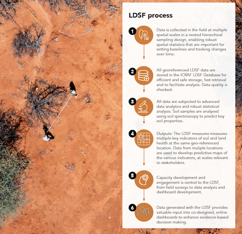
The Land Degradation Surveillance Framework (LDSF) is a comprehensive method, developed by CIFOR-ICRAF scientists, that provides a science-based field protocol for measuring land and soil characteristics, as well as vegetation composition and land degradation status over time.
The authors explain that LDSF was developed as a response to a lack of methods for systematic landscape-level assessment of soil and ecosystem health, using a robust and consistent indicator framework.
“The LDSF is designed to provide a biophysical baseline at landscape level, and a monitoring and evaluation framework for assessing processes of land degradation and the effectiveness of rehabilitation measures (recovery) over time. This is of particular importance for understanding land degradation processes, predicting changes in climate, prioritizing sitespecific land management options and tracking the impact of interventions on the ground.”
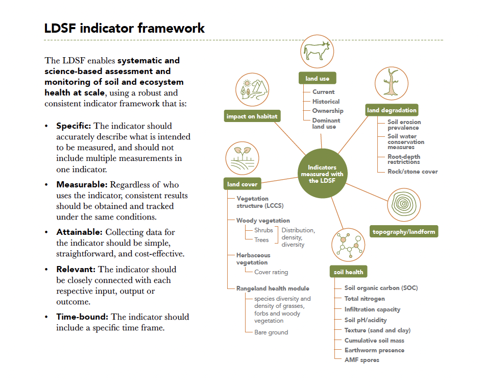
Implemented by a range of partners in over 40 countries since 2005, the LDSF provides a consistent set of indicators and field protocol to assess the health of an ecosystem. Indicators measured with the LDSF include vegetation cover and structure, tree, shrub and grass species diversity, current and historical land use, soil properties (soil organic carbon stocks for assessing climate change mitigation potential, total nitrogen, infiltration capacity, texture, etc.) and soil erosion prevalence.
Some of the Landscapes For Our Future (LFF) projects have eagerly requested information on this and been excited about the potential. Whether you are part of one of LFF’s 22 projects or not, feel free to contact us to connect you with the LDSF team.