Over recent months, the LFF Central Component in Latin America has been collaborating with EU-funded Integrated Landscape Management (ILM) initiatives to gain a deeper understanding of how different dimensions of ILM function in practice, particularly iterative and adaptive learning.
Iterative and adaptive learning are key characteristics of effective ILM initiatives. This is because landscapes are highly complex and dynamic socio-ecological systems with multiple and dynamic interacting elements and a high degree of uncertainty about how they will evolve.
“A socio-ecological system is an integrated system of people and nature, where ecological and social components are interdependent and co-evolve through feedbacks.”
— Elinor Ostrom, 2009
As we described in our Landscapes in Practice guideline, iterative learning is a continuous, cyclical process of learning through action, reflection, and adjustment. It involves testing ideas or strategies, observing the results, gathering feedback, and then refining approaches based on what was learned. Rather than following a fixed plan, iterative learning enables adaptation over time, particularly in complex or dynamic environments. Without iterative learning processes, initiatives can fall into a trap of static planning and top-down technocratic fixes. This process of identifying best practices and improving over time is often described as a ‘learning by doing’ approach.
To encourage ILM proponents to reflect on the role of iterative and adaptive learning in their work, the LFF team has been facilitating reflective activities with these ILM practitioners, supporting them as they learn from their own experiences.
Facilitation has included group exchanges, workshops, bilateral discussions, and peer exchanges across regions.
In November 2024, the Central Component organized an Iterative Learning Webinar, which brought together colleagues from multiple ILM projects, including Paisajes Andinos (Ecuador), Mi Biósfera (Honduras), the OECS-ILM Project (Organization of Eastern Caribbean States), and Paisajes Sostenibles (Colombia).
This gathering focused on knowledge sharing and dialogue among ILM practitioners in the region to highlight practical solutions and approaches for iterative learning and encouraging reflection on governance, institutionalization, and stakeholder engagement for adaptive management.
LFF partners emphasized the critical role of cross-sector partnerships in advancing sustainable landscape outcomes. Speakers stressed that building and maintaining these partnerships – especially across governments, communities, and NGOs – is not always easy, especially amid changing political and financial contexts. Yet, it is precisely this collaborative spirit that enables long-term impact, and landscape approaches are, by nature, long-term investments.
Khalil Walji, representing the LFF Central Component, noted: “Through our Joint Reflection and Learning Missions, we’ve seen firsthand how collaborative learning can lead to significant improvements in land restoration efforts.”
Participants exchanged fresh ideas on innovative strategies to bolster these alliances, such as participatory governance models and capacity-building initiatives, ultimately highlighting the essential role of cooperation in driving sustainable outcomes in landscape management.
The webinar highlighted LFF’s strategy of fostering collaboration among projects to improve practices and outcomes by learning from one another.
A common thread among the experiences was the value of integrating local knowledge into landscape management strategies and giving voice and ownership of the process to local resource managers. We believe the integration of local knowledge into our practices is essential for achieving sustainability in landscape management.
Lessons from the field: How has adaptation manifested across LFF landscapes?
Ecuador – Paisajes Andinos
During our March (2025) visit to Ecuador, the Paisajes Andinos team recounted the approach they had used to support community conservation of a threatened páramo landscape in the Simiátug parish. Rather than imposing a predefined conservation model, the project supported local stakeholders in exploring governance mechanisms through exchange visits and dialogues. They had initiated a process where communities visited others to learn from their experiences, which helped target communities surrounding the paramo learn from their experiences. This, in turn, enabled the communities surrounding the targeted páramos to identify potential governance mechanisms that conserved resources and secured rights. The project had also invested time in building trust between the communities and Ecuador’s Ministry of Environment. As a result, the communities had decided that a mechanism known as a Hydrological Protection Area was best suited to their needs and had joined local and national government, NGOs and FAO in a collaborative effort to demarcate and develop it.
Colombia – Paisajes Sostenibles
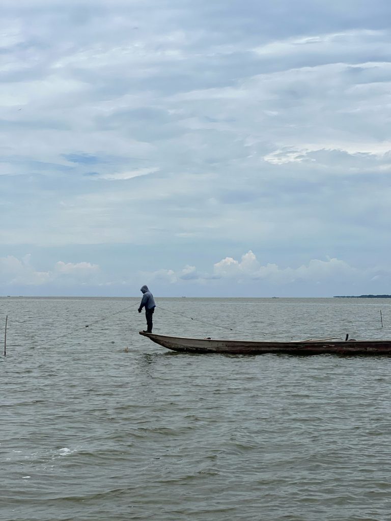
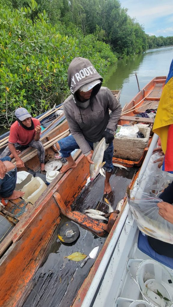
During an April 2025 learning mission to Santa Marta, Colombia, staff from the Paisajes Sostenibles partner INVEMAR recounted their experience working with fisherfolk in the Ciénaga Grande de Santa Marta (CGSM). In response to observed declines in the blue crab stock due to overfishing, technicians introduced innovative traps that included openings allowing juvenile crabs to escape. During monitoring visits, the technicians noticed that many fishers had blocked the openings and continued harvesting crabs regardless of the stage of growth. As a result, the INVEMAR technicians changed their strategy and implemented a participatory experiment with fishers to monitor harvests using these innovative traps. Through this process, fishers realized that concentrating only on larger crabs would not diminish their harvest but would ensure more crabs for the future. Acceptance of the modified traps expanded because fishers not only now saw how they worked but also felt ownership, as this was a solution they had validated.
Brazil-Paraguay – Cerrado Resiliente
During our May 2025 visit to Paraguay, technicians for the CERES (Cerrado Resiliente) project used a flexible planning approach that allowed them to facilitate iterative learning cycles with stakeholders in the Agua Dulce zone around the Monumento Natural Cerro Chovoreca. The project’s initial proposals (e.g., formal biological corridors) had proven unviable due to conflicting interests among stakeholders. Rather than insisting on these original ideas, the project shifted focus to socializing the idea of connectivity through maps and dialogue, gaining legitimacy without resistance. Through this process, they were able to aggregate local interest around a strategy to demarcate the Cerro Chovoreca conservation area, which would allow local landowners to also clarify their property boundaries. This reframing helped shift attention from a potentially divisive intervention to a collaborative vision of landscape governance. Collaboration among government agencies, local communities, the private sector and NGOs resulted in the institutionalization of landscape governance in the frontier area. In short, adaptive learning ensured progress in a politically sensitive, ecologically important, and operationally challenging setting.
Iterative learning is emerging as a powerful driver of action across LFF landscapes by enabling projects to remain responsive, adaptive, and grounded in local realities. Rather than relying on rigid plans, project teams embrace flexible, feedback-driven approaches that allow them to learn alongside communities, adjust strategies based on real-time insights, and co-create solutions that are both effective and locally legitimate. Whether through peer exchanges in Ecuador, participatory experiments in Colombia, or adaptive planning in Paraguay, this continuous learning process is helping overcome political, ecological, and social challenges, translating reflection into tangible progress on the ground.